Matt Bark and his pals James and James embark on a rail journey with a difference. Repurposed rail trails provide easy miles, away from traffic. On this trip they load their bikes with camping gear and link up 6 trails around Norfolk.
Oh Doctor Beeching!
The Beeching Report of 1963 led to the closure and removal of many British railway lines. Withdrawing what many considered vital services from villages and suburban areas alike. Whatever your thoughts on the loss of rural rail services, these cuts did however pave the way for subsequent conversion to the so called “rail trails”. Providing over 2,000 miles of traffic free paths for pedestrians, horses and cyclists. Green corridors perfect for leisure and exercise. For the cyclist wanting easy miles with an escape from tarmac and busy roads, they provide an ideal playground.
Here in Norfolk, we are blessed with one of the longest such trails in the UK. Marriott’s Way takes in 26 blissfully traffic free miles of Norfolk countryside from Norwich to Aylsham. But other, maybe less well known, trails exist here as well. On this trip we set out to cover as many of them as we could. If no rail trail existed, we would, wherever possible, find off-road or otherwise traffic free sections to link them all up. To make an adventure of it and to allow time to enjoy the sights, we split the route into two, with an overnight camp in the middle. I was joined by two friends, James and James; Next time we’ll get another James in on the trip so I can really feel the odd one out.

The Route
Planning a trip along rail trails is usually a fairly simple exercise. Out-and-back style trips with a coffee stop at one end, suit them well. Their use can extend beyond the simple there-and-back formula though. Linking Marriott’s Way with the Bure Valley Railway and some bridleways is a personal regular 50 mile gravel blast. However, once you want to add more trails in, want to minimise road sections or want to find a campsite along the way, planning gets a bit more involved.
Our rail trails would include Marriott’s Way, the Weaver’s Way, the Paston Way, the Weaver’s Way again (a different section), the Bure Valley Railway and the Lakenham Way. The task of linking these together meant time spent poring over various maps and the Strava Heat Map function. Adjusting and readjusting, finding the best combination of tracks possible. An interesting part of the adventure in itself to some, a chore to others. For the latter, services like Komoot are making it easier to find and plan routes.
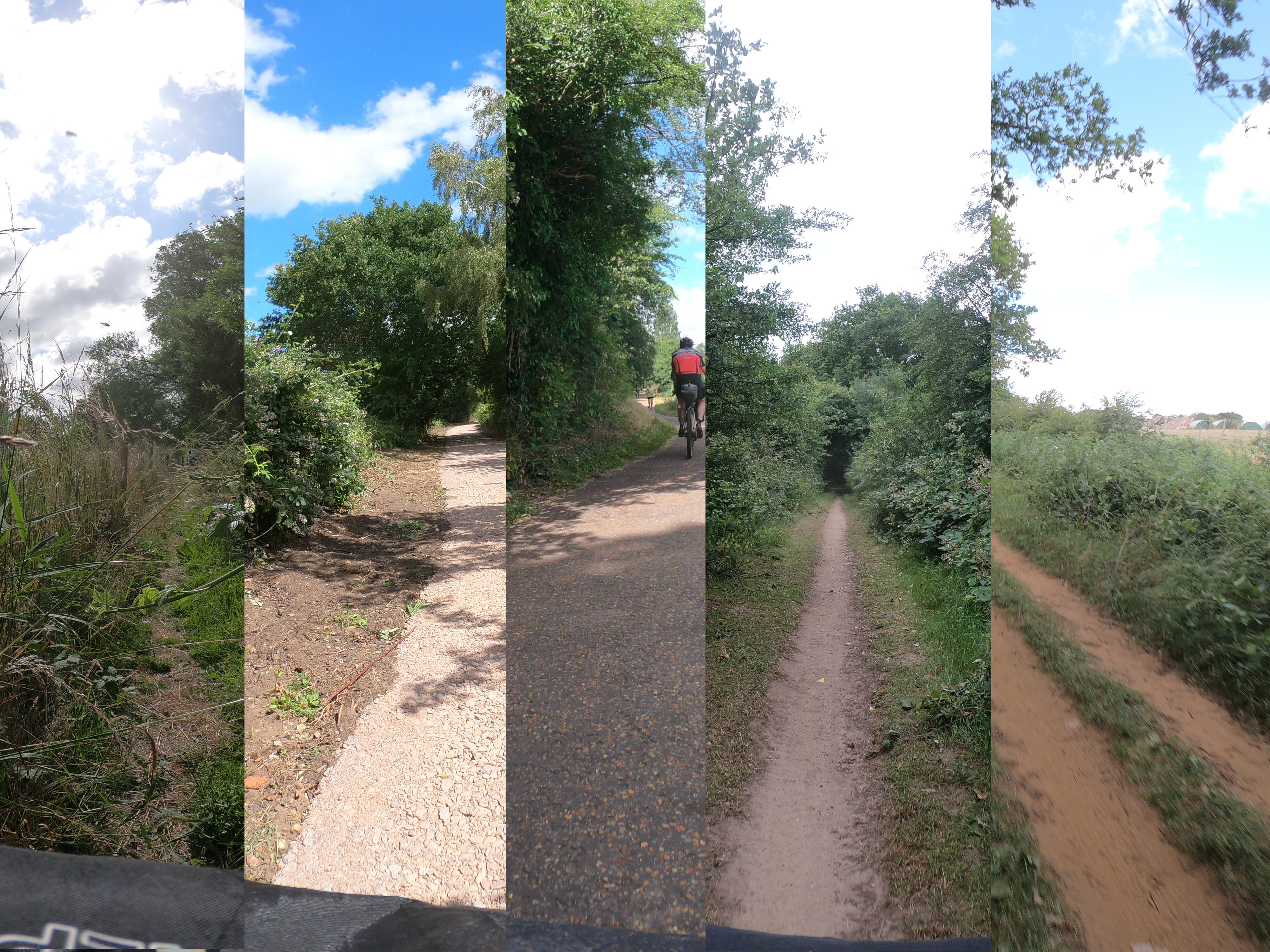
About 70% of the 100 mile route is on bridleways or designated traffic free cycle paths. To avoid roads, the odd footpath* is used; though these were generally wide and well surfaced. The Paston Way is technically classified as a footpath and does include quite a few steps where bridges have been removed.
Standard road tarmac aside, the surfaces on the route vary, from the asphalt cycle path of the Lakenham Way back into Norwich, through sandy double track and dusty single track to forearm juddering rutted sections of the Weaver’s Way. It is worth mentioning though, that much of the Weaver’s Way is still in the midst of resurfacing works. The already finished sections were glorious riding on 35mm tyres.
The Gear
At the time of this trip, I should have been on a two week tour of Northern Scotland. I had purchased a few bits of new gear with that trip in mind. Unfortunately, with events as they have been this year, the Scotland trip was cancelled. So, for me, this was a chance to test some of my acquisitions. Both of the James’ are seasoned cyclists, but fairly new to the bikepacking scene. This ride was a chance for them experience bikepacking without straying too far from home.
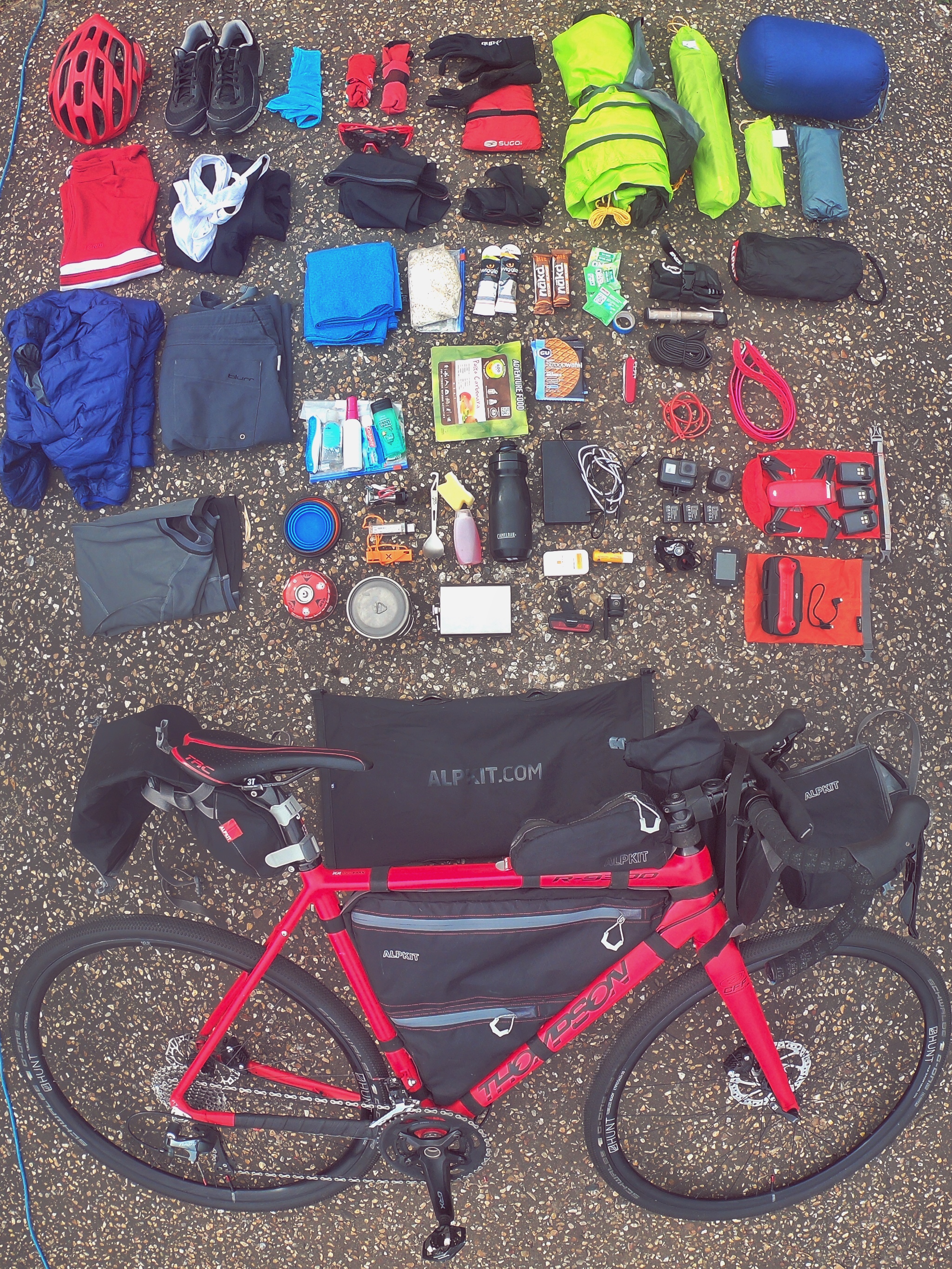
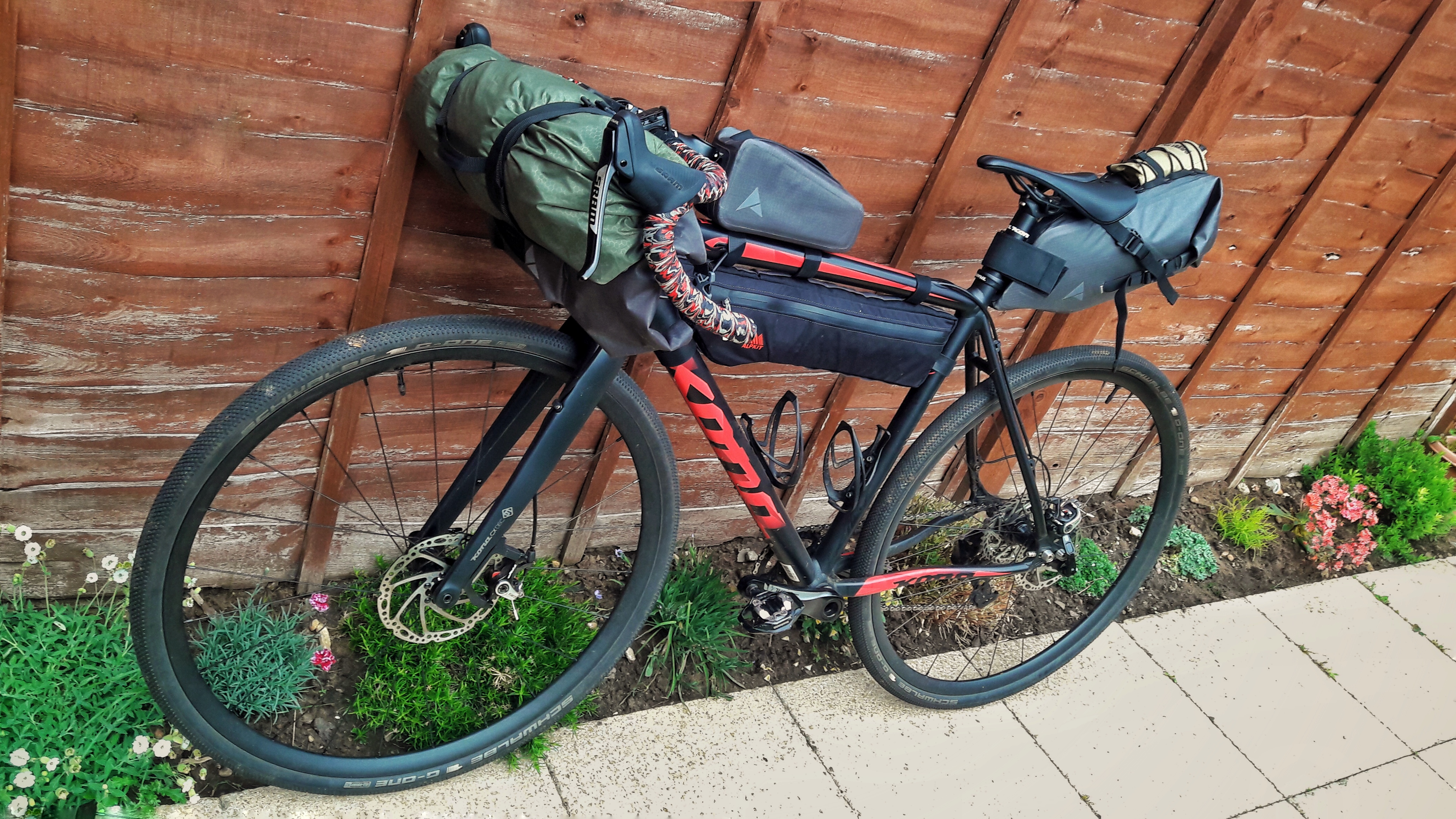
Matt’s Thompson R9300 and all his kit for the Rail Trail Adventure.
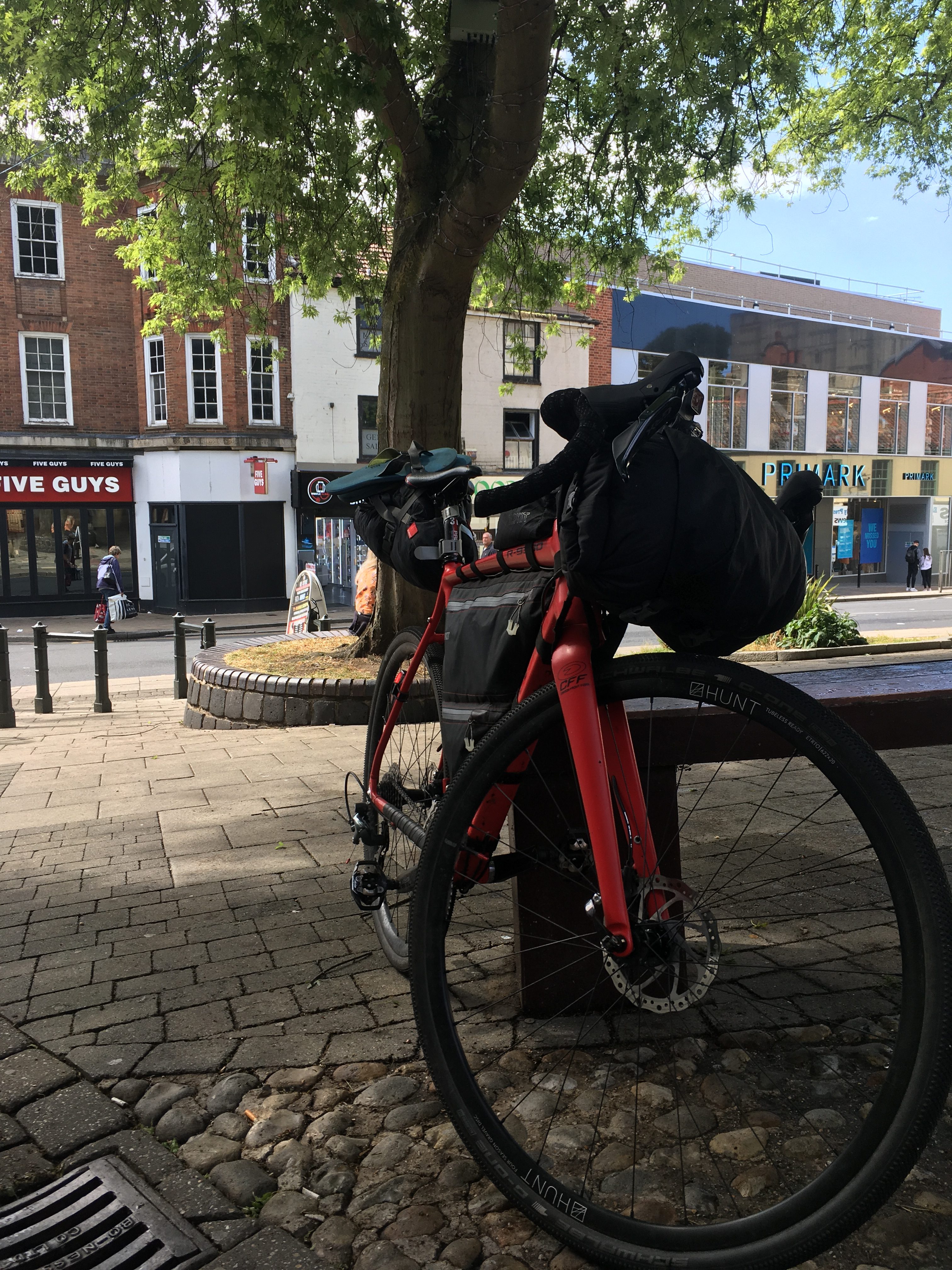
As with previous bikepacking trips, I loaded everything onto my Thompson R9300 Gravel bike. A steed that has carried my luggage along Brighton sea-front, through the Outer Hebrides and even to work. Being limited to 35mm tyres is it’s main weakness. I loaded it up with some of my original Alpkit bags as well as a new custom made Alpkit Stingray full frame bag that arrived a few weeks ago.
For James, his shiny new Salsa Fargo Ti was the weapon of choice. 29er boost wheels with 50mm of Panaracer GravelKing would smooth out the rougher sections. The plethora of mounting points dotted around the frame and fork gave him plenty of carrying capacity for his selection of Apidura and Restrap luggage.
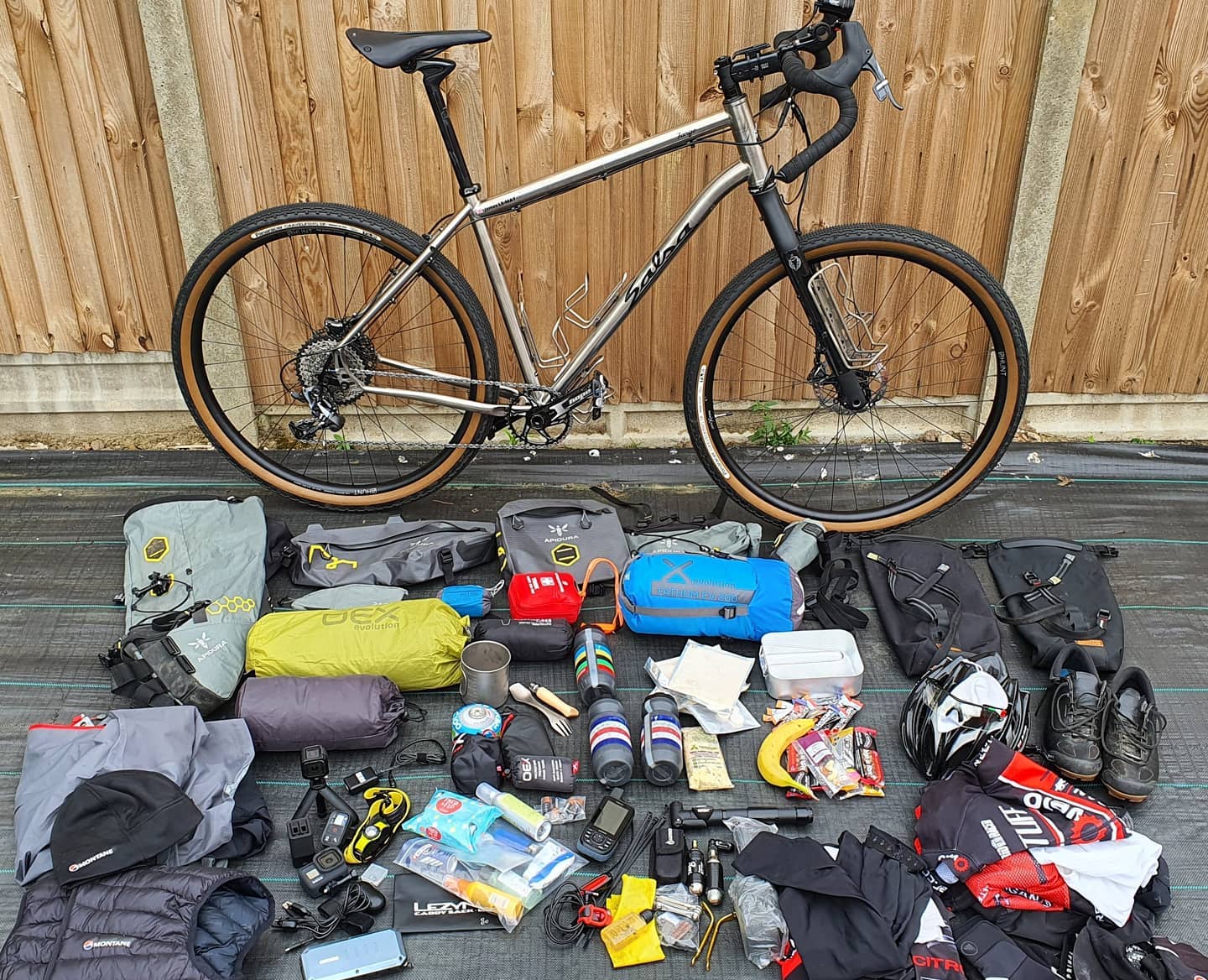
Adventure by Bike. The Salsa Fargo Ti belonging to James 1.
For the other James, his Kona Private Jake would once again roll alongside my Thompson. A new Alpkit frame bag, but otherwise unchanged from his Altura setup from our Brighton trip last year. We are currently still traumatised by the lack of gear grid photo submission by James.
“Sorry lads, the bags are packed. I’m not taking it all out again”
Marriott’s, Weaver’s and Paston Way
The ride started with a meet outside a coffee shop in Norwich. Stood in the morning sun, sipping rich black Americanos, we scrutinised each others kit and reeled off bike specs to each other. “What width are those tyres?”, “How much flare have your bars got?” – pure bike geekery.
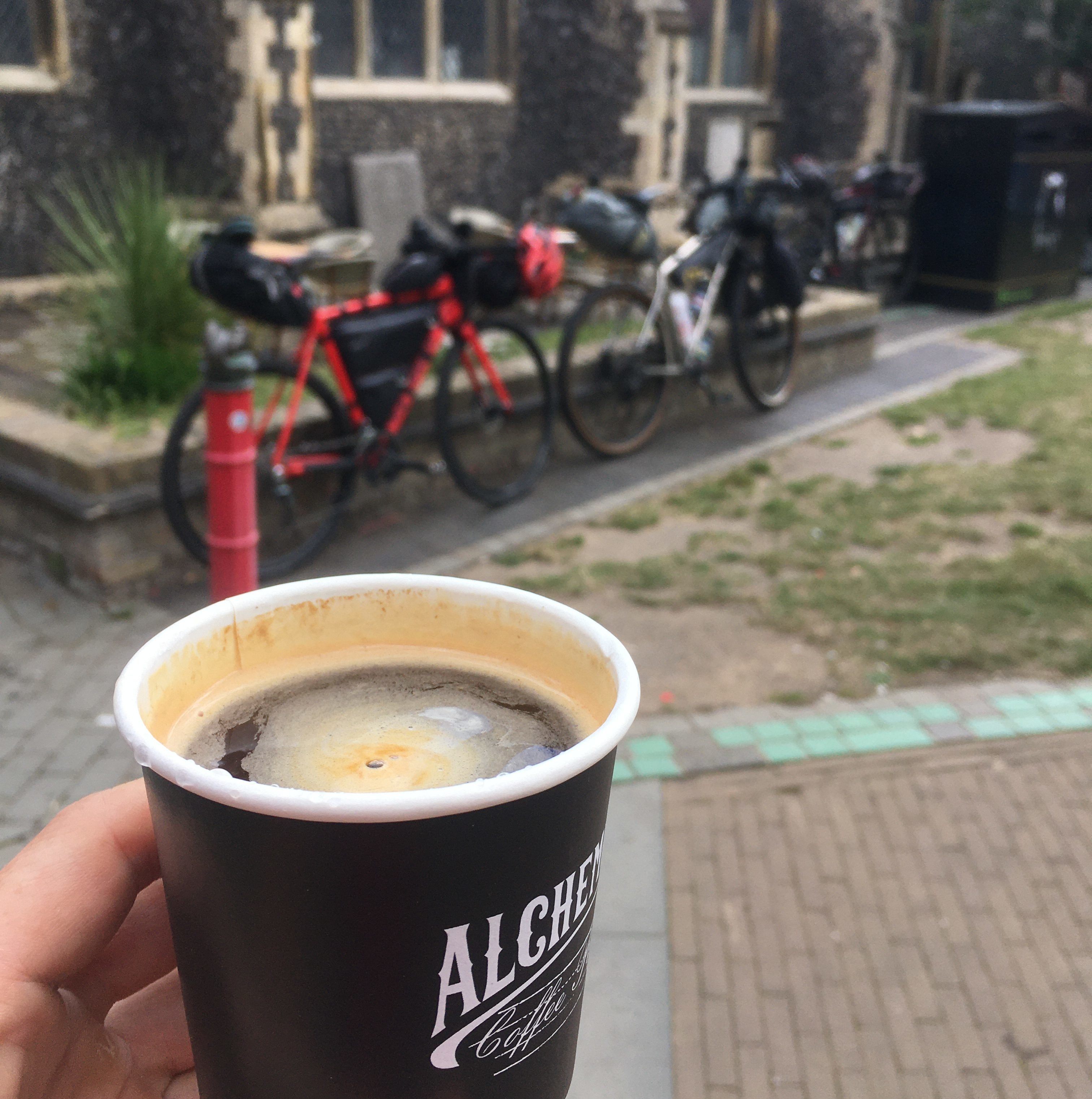
All good rides start with coffee.
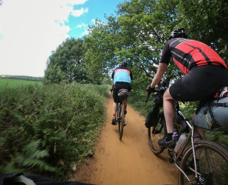
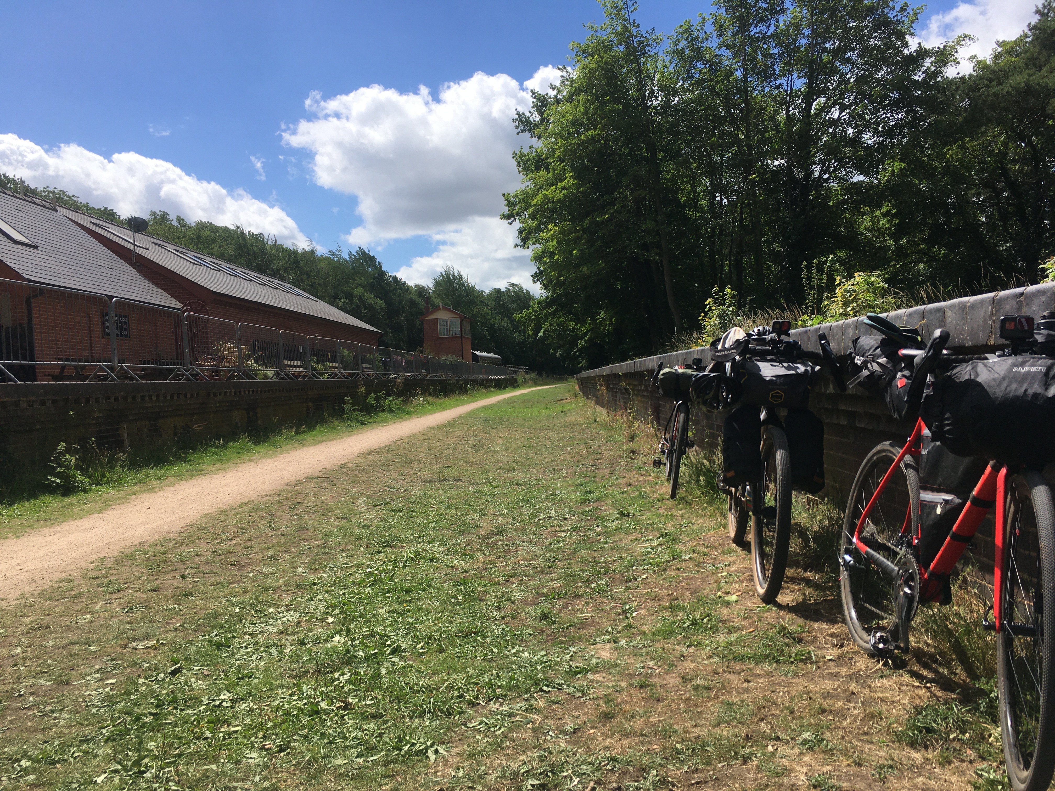
Being such a well frequented route for all of us, riding along Marriott’s Way is something of a non-event normally. But, loaded up and with an ethos of taking it steady, we gained a new sense of adventure to a well rehearsed ride. You take time to appreciate the bridges, point out the best views and discuss how many miles is acceptable before another coffee stop. The cuttings and lineside trees of rail trails providing shelter from the gusting winds.
Line up.
Marriott’s Way is actually a linking of two railway lines; the East Norfolk Railway and the Midland and Great Northern Joint Railway. Operation on some parts of which survived the Beeching axe, continuing to serve a concrete factory at Lenwade until 1985. The Themelthorpe curve, the tightest curve on the British rail network at the time, linked the two lines. This can easily be cut out of the ride by a short road section between Whitwell and Reepham, but, for the purposes of completeness, we included it.
In Aylsham we stopped for pies from the Cheese and Pie Man van, his presence that day a lucky coincidence, before setting off for Weaver’s way. I was justifiably chided for appearing to give chase to two eMTBers who zoomed off from a junction. But we all settled back in to the steady pace. Swapping tales to the sound of gravel rolling below. Not all gravel is made equal however, James was deservedly smug as his larger tyres and suspension stem soaked up the rough stuff on some sections.

Always make time for pie.
The Weaver’s Way follows sections of the M&GN line which ran from Great Yarmouth to the Midlands. Other uses have, unfortunately, consumed much of the line. Although the council have plans for further sections that could be converted. Whilst the Paston Way, nominally a footpath, initially follows the trackbed of the Norfolk and Suffolk Joint Railway line from North Walsham to Cromer, the rail trail ends after only 1½ miles.

Weaving on the Weaver’s Way.
The Paston Way meant navigating stairs, a tricky challenge with loaded bikes. Whilst the second section of Weaver’s Way gave some of the roughest riding of the route (though improvements appear to be in development). A pint in Stalham and we finished the last few miles to the campsite in Hickling under the warming evening sun.
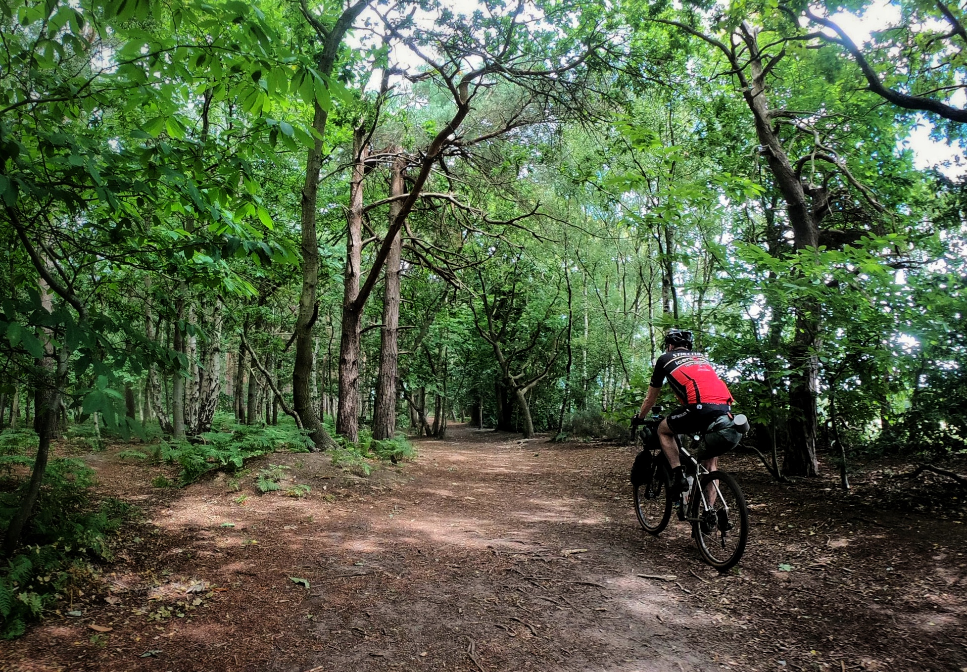
Welcome shade from the heat of the day.
The Camp
Arriving at the campsite, James noted the “inquisitive nature of others when they see you rock up with bikepacking gear”. Your arrival is abstract to those already there. Though maybe not as abstract as the family with a full on sailing boat (yes, on a campsite). Whilst bikepacking would typically suggest sharing the load to minimise weight, we all carried individual tents, using this as a dry run for possible future trips.
Alongside some of the new luggage options for each of us, we were also all trying out some new gear on the trip. New tents all round (though one James was just borrowing my old one), a new stove here or new sleeping bag there were all unloaded and suitably peer-reviewed before use. Kind weather meant we sat outside tents to cook dinners over camping stoves before relaxing in a nearby beer garden.
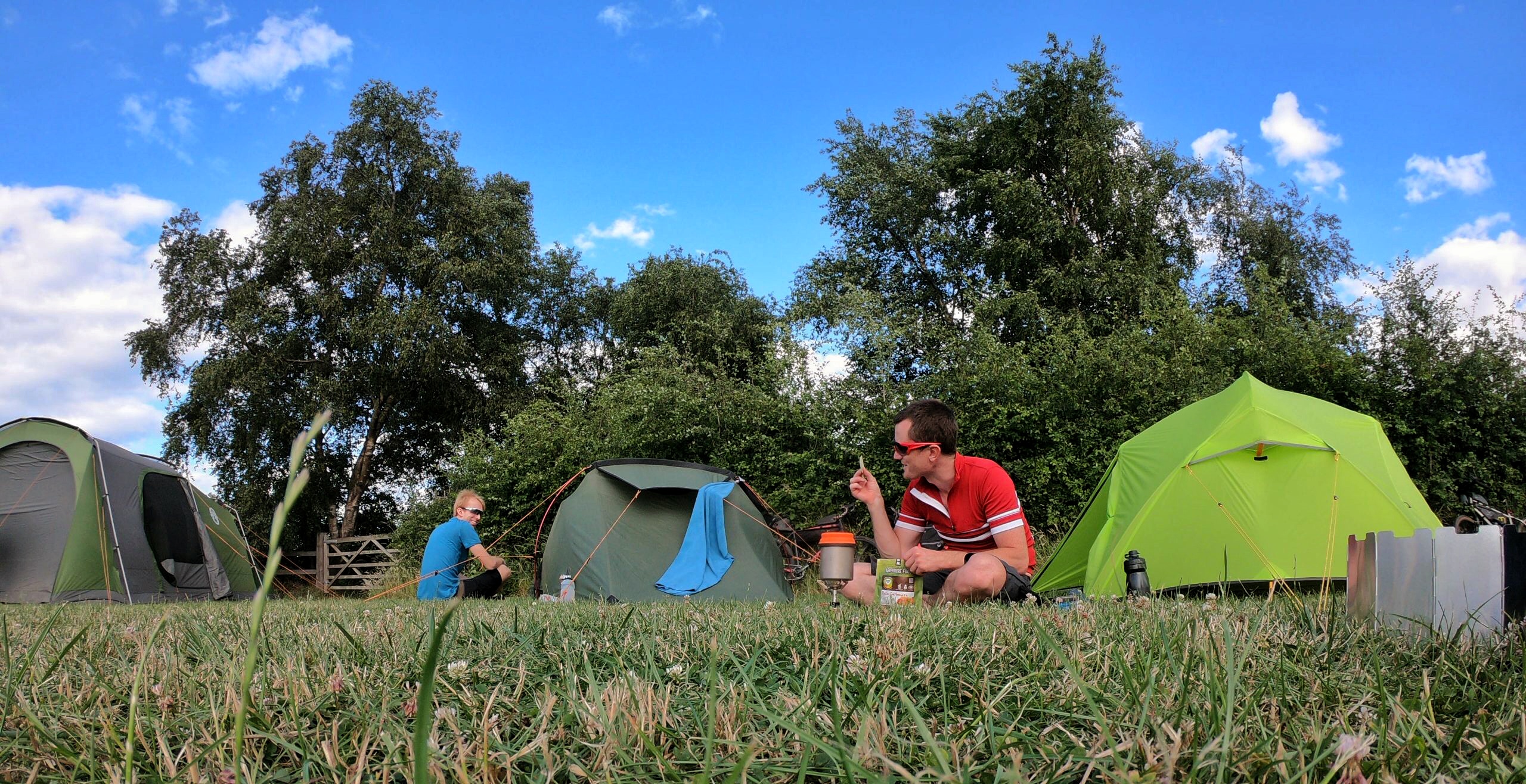
Happy Campers.
I woke to dappled sunshine on the tent, having had a glorious nights sleep in my palatial abode (relative to the other two tents). One James complained that his sleeping bag was maybe slightly on the thin side. The other that his tent was too short. I may have had the heaviest bike, but I’ll gladly trade that for the comfort on longer trips. A few nights in a bivvy I can cope with. For two weeks touring however, I wanted more space to relax in.
Bure Valley and Lakenham Way
Day two was, by my own admission, a bit more zig-zag. Picking up Restricted Byways and Bridleways to criss-cross our way through the Broads to Wroxham. 20 miles in, two coffee stops down already, we were taking the relaxed pace to heart again. The Bure Valley Railway was next, a slender single track running alongside the narrow gauge tourist railway. Under normal circumstances you will often see tiny carriages with families peering out at you as you cycle along here. Though with Coronavirus restrictions still in place, the attraction is yet to reopen and the rails remain quiet.
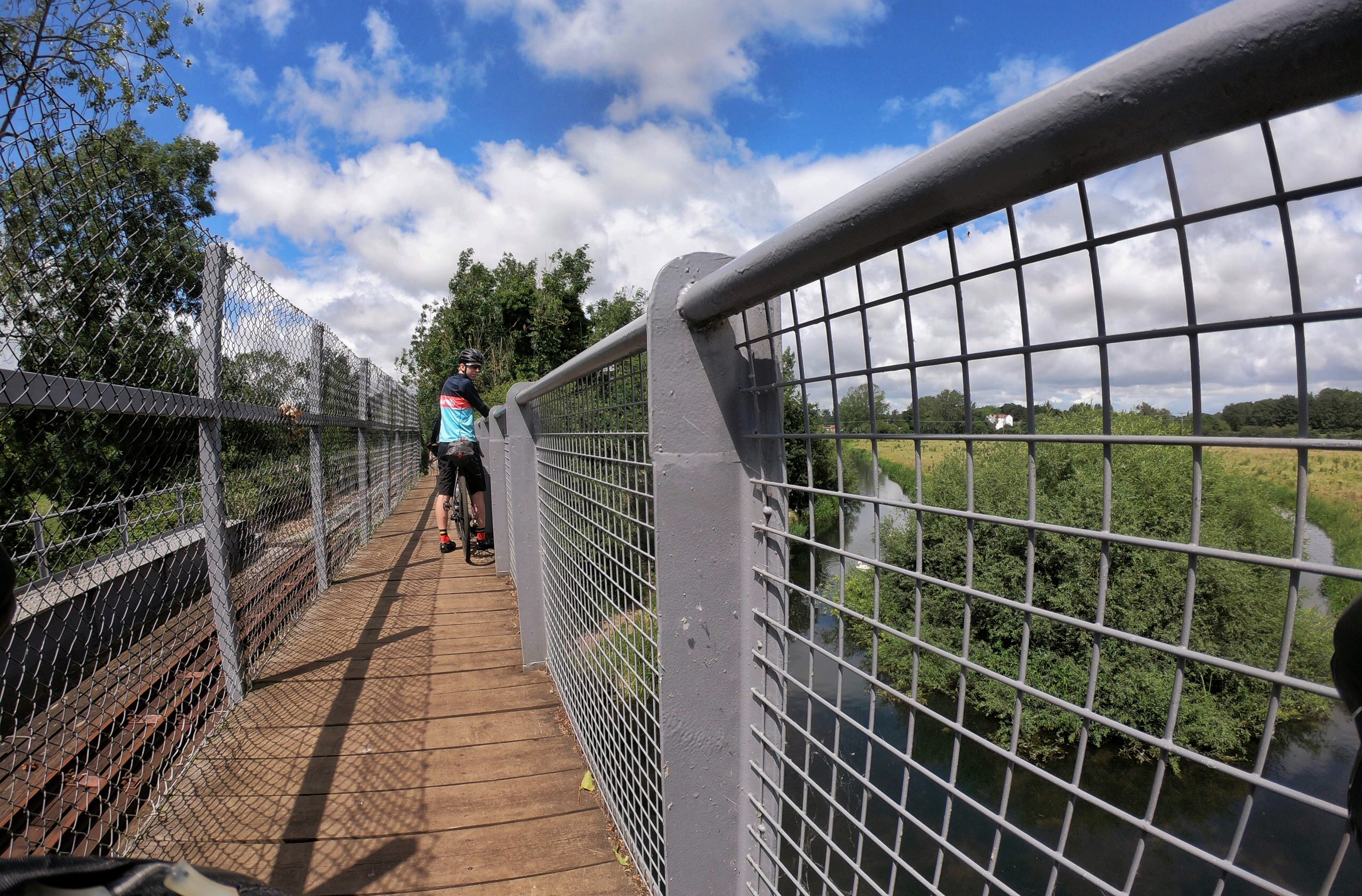
Broads Crossing.
As we continued to wind our way along dirt tracks through the Norfolk countryside, the clouds began to build above. “Let’s just aim for that sunny patch between the two rain storms” joked James pointing at a slightly lighter area of grey clouds. It was wishful thinking, our route being dictated by that of the railway line. Though, somehow, we managed to do exactly that. Later in the ride however, we were not so lucky, diving into a garage workshop just as a wall of water thundered down. The mechanics inside happy to lend us shelter for 10 minutes or so.

Ever get the feeling you are about to get very wet?
With no obvious end to the gentle rain that followed, we set out again with rain jackets on to complete the end of the ride. We skirt around Norwich on the Northern bypass cycleway (which I will always know as the NDR, despite the council’s best efforts at renaming it). With wet shorts we roll past Whitlingham Broad, the route leading us towards our final rail trail, the Lakenham Way.
The Lakenham Way is the shortest of our rail trails at just 1 mile. This section of inner city line used to bring the Great Eastern Mainline into Norwich Victoria Station. The station area now converted to an office block and a Sainsbury’s supermarket. The line provides a peaceful route right into the city centre, away from the more arterial roads. We celebrate completion of our micro adventure with a quick burger in the city, before heading home to shower, unpack and rest.
Fin.
Cycling the Rail Trails
If you want to ride the rail trails yourself, it’s easy plan a route along the popular trails on Komoot. 35mm tyres are suitable, if not a little uncomfortable on some of the rougher sections. Resupply options are abundant and other accommodation options can surely be found around Stalham if camping is not your thing. It would also make a good single day gravel epic.
Beyond Norfolk, a useful list of rail trails can be found here. Personal favourites around the country include: the Monsal Trail (Peak District), for the tunnels; The Downs Link (Shoreham-by-Sea) for the distance it covers; The Drake’s Trail (Plymouth) for the ponies; and Granite & Gears (Dartmoor) for something a bit more off-road.
Follow Matt’s adventures on Instagram here.
* It is considered a ‘civil wrong’ to ride a bicycle on footpaths in England and Wales. If the landowner can find evidence that you have caused damage to their property, you can be prosecuted. Ride cheeky trails at your own risk, don’t be a dick, be pleasant to others you may pass etc. Maybe one day, we’ll see a change in this absurd, draconian law.
Last modified: 13th July 2020


Hi Matt this is great! I have known Marriotts Way all my life and have recently linked the Bure Valley path. I had never thought to link Weavers or Paston before! Any chance you can share your Komoot route?
Steve, if doing the Marriott’s and Bure Loop, once in Wroxham look for Church Lane>Skinners Lane>Sloe Lane for an off road/quiet road route back to the NDR. I then follow the NDR round to Postwick, over the bridge and down to Whitlingham for my gravel loop.
The two days for this trip are on Komoot here:
https://www.komoot.com/tour/219810922
https://www.komoot.com/tour/219811109
Great route and right on my doorstep
I’m not too far away from this route. Going to ride it at a suitable time.
Go to https://www.norfolk.gov.uk/out-and-about-in-norfolk/norfolk-trails/cycle-routes/marriotts-way for map and interactive maps.