Back in November we posted news on a bikepacking event taking place in January 2018, The Bearbones Café Racer. If you want to enter, sorry but you’re too late! You can read the full details in our news piece but the summary is as follows:
On Christmas Eve, three weeks before the event, you will receive OS Map grid references that you’ll use to plot a cross country route from the start in Llanbrynmair in Mid-Wales to a mystery location. The event name always holds a clue as to where you might be heading!
A couple of weeks after the news item we spoke to first time bikepacker James Pearson who, having seen the article, signed up for the Café Racer and invited us along to join him in the preparation and planning for his first bike packing adventure. Nigel Leech picks up the story and formulates a plan…
First things first…
The first step was to make sure that the quantity of mince pies and sherry consumed on Christmas Eve didn’t lead to missing the email from the event organiser. When the Grid References and the destination were made public I followed my usual process. Get out the paper maps and mark all the way points with small stickers.
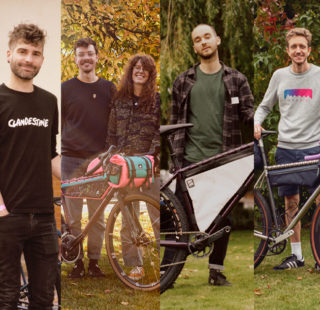
James meanwhile, sat down and carefully sorted out his kit for the ride and how best to pack it…
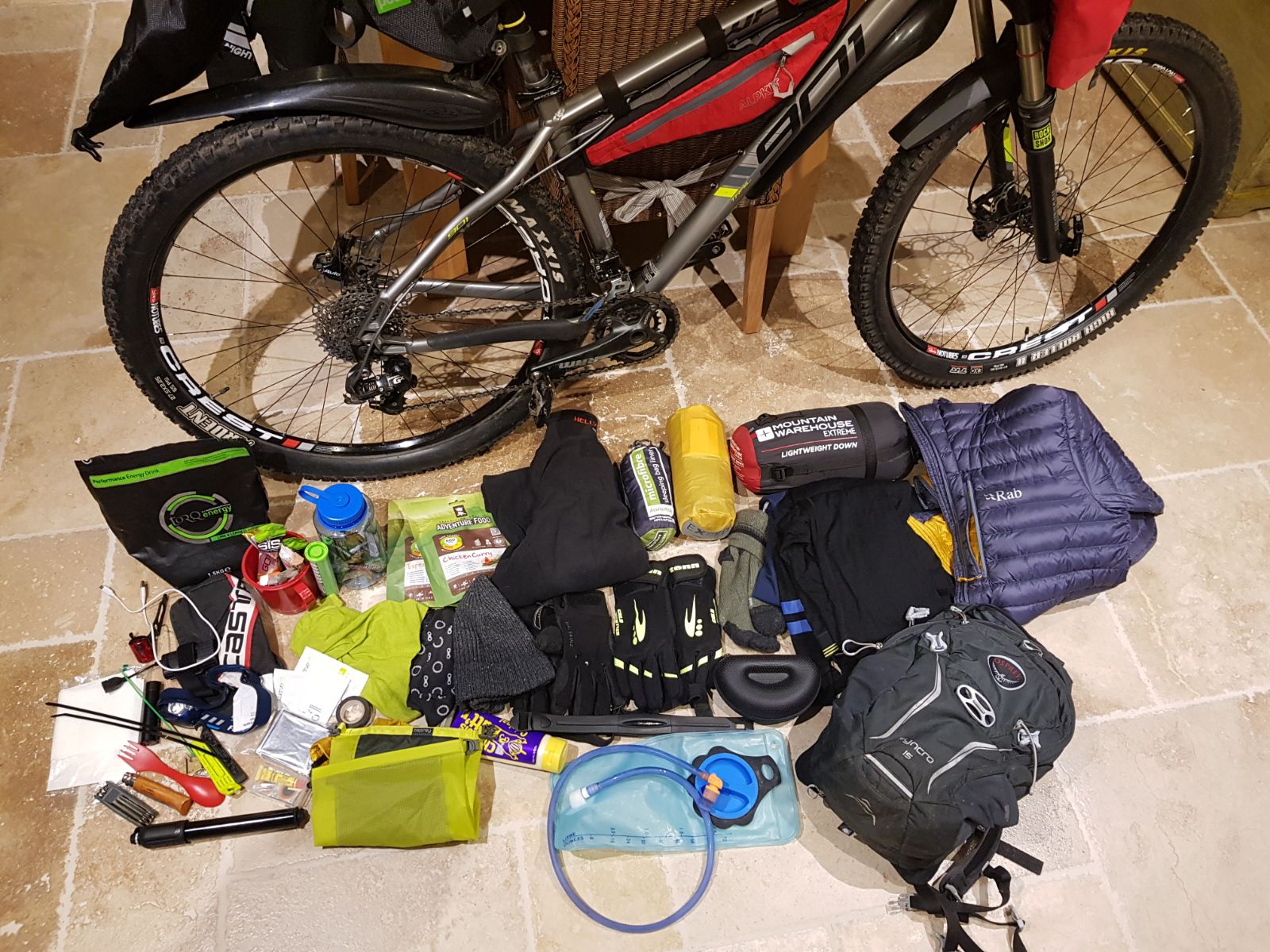
All this WILL fit into the bags…
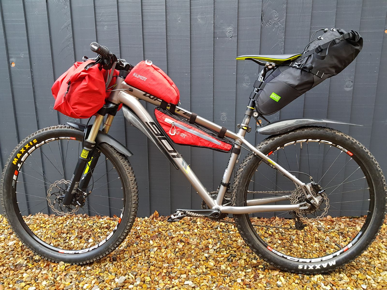
Ready for the Cafe Racer. James Pearson’s carefully loaded bikepacking rig.
I’ve been a GPS and Online GPX user for a number of years but I still don’t think anything beats opening out a big OS map to get the big picture about the area you plan to ride through. Choosing your route between the way points comes down to a compromise of the following:
- Time/Distance: How much time do you want to put in the saddle?
- Terrain: While Off-road riding is generally more scenic, it is also usually slower going, will you cover the distance in the time you have?
- Personal experience: If you’ve been to the area before are there areas you know to avoid?
- Likely conditions: A route that would be great in the Summer could be awful in Winter. Waterlogged trails become an exercise in carrying and pushing and that stream you could hop across has become a full blown river
- Resupply points: How self-reliant will you be? Do you need to consider resupply points or will you carry all your food?
- Bivi spot: You need to find a spot that suits your shelter system and that exhausts you to get there. You also need to think about how far you are prepared to travel the next day to get back to the start.
Putting a plan together…
With all these in mind my ideas were as follows:
As this was James’ first bike-packing trip it needed to an adventure while still being enjoyable! Heading South from Llanbrynmair involves about 10 km of climbing. Better to get that out of the way on Tarmac, it’s a quick win and will warm us up on what will almost certainly be a cold day! A couple of km further and we pass through Staylittle (one of the last places to get web access in UK!) and then into Hafren Forest.
Hafren is teaming with trails from singletrack, to tarmac. We’ll ride 15km through the Forest to Llanidloes. We don’t plan to stop but this is a contingency in case the weather takes a turn for the worse.
From Llanidloes it’s another 15km to the eponymous Cafe of the event, on the Glyn Dwr Way in Bwlch-y-Sarnau. We’ll swap from bridleway to tarmac on this section to help maintain our average speed and reduce any potential loss of morale from sodden trails.
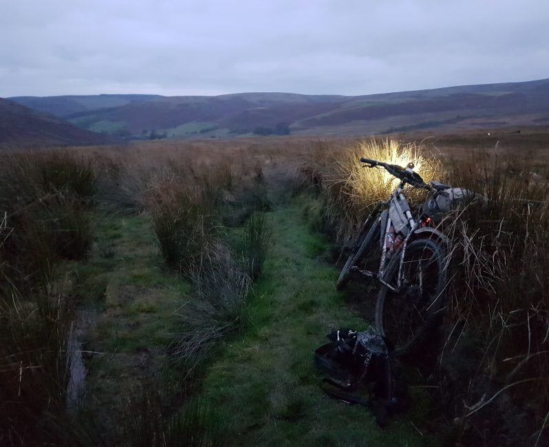
Our plan is to head directly west from the Cafe towards the Wind Farm above the River Wye. Depending on conditions there are Bivi spot options among the trees on the climb to the summit, or on the plateau upon which the wind farm is sited. If it seems too wild on top then the gravel access roads can have us down by the 8-81 Sustrans route that follows the Wye and has a areas that are suitable for night’s bivi.
Day two is unashamedly planned to be easier. We’ll take the Sustrans route to Llanidloes for a well deserved fry-up and then back into Hafren Forest, but this time skirting around Llyn Clywedog to reach Staylittle. Here we can decide to take the road back (10km of descent!) or head up into Dylife and take the bridleway descent into Pennant before rejoining the tarmac.
We’ll find out how our intrepid duo got on at the Bearbones Café Racer next week. Stay tuned!
Last modified: 9th January 2018


